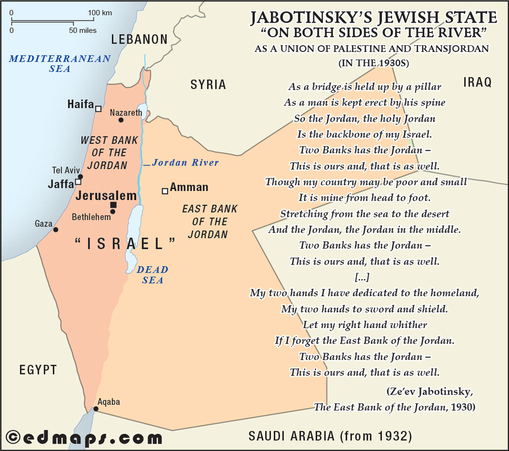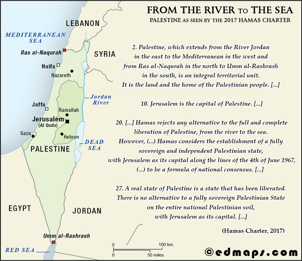
This page presents a collection of original historical maps related to the region commonly referred to as Israel and Palestine, illustrating key moments in its territorial, administrative, and political evolution from the early 20th century to the present day. Each map is accompanied by a concise historical explanation and is presented independently to highlight specific proposals, plans, or territorial visions that have influenced the region’s modern geography. The collection is intended for educational use and aims to provide clear, factual, and balanced visual resources without implying any political interpretation or position.
See also :
Palestine in Ten Maps — original historical maps of the territorial evolution of the Palestinian Question;
Israel and Palestine on the Map — original historical maps of the territorial evolution of Israel and Palestine;
Historical Maps of Israel & Palestine — curated links to historical maps and resources covering Israeli and Palestinian history;
Historical Geography of Palestine — maps from G. A. Smith, Atlas of the Historical Geography of the Holy Land (1915).
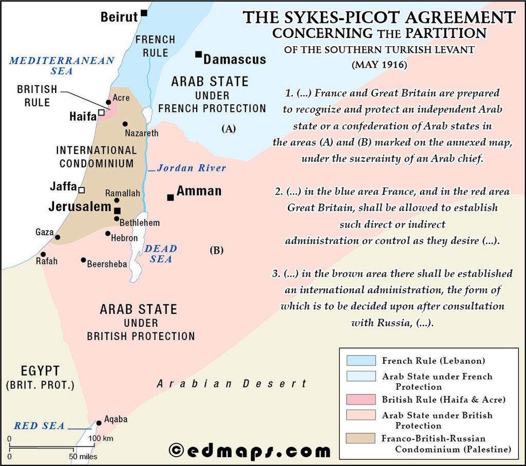
This agreement divided Ottoman Middle East territories between Britain and France, creating spheres of influence in modern-day Syria, Iraq, Lebanon, and Palestine.
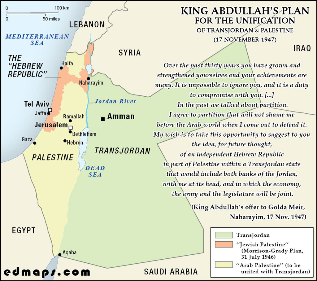
In 1947, King Abdullah I proposed annexing Arab Palestine to Transjordan, offering Jewish autonomy within an enlarged kingdom, rejected by Zionists seeking an independent state.
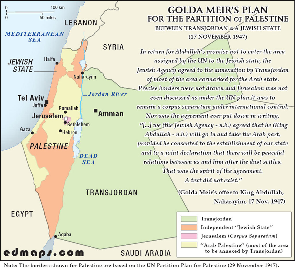
Golda Meir, representing the Jewish Agency, supported the UN Partition Plan (1947), advocating for an independent Jewish state alongside an Arab state in Palestine and Transjordan.
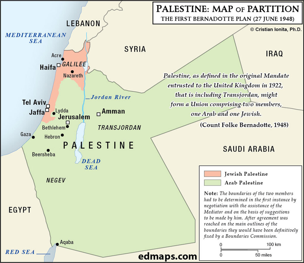
Count Bernadotte's June 1948 plan proposed a Palestine-Transjordan union with two autonomous members, one Arab and one Jewish, controlling their own affairs.
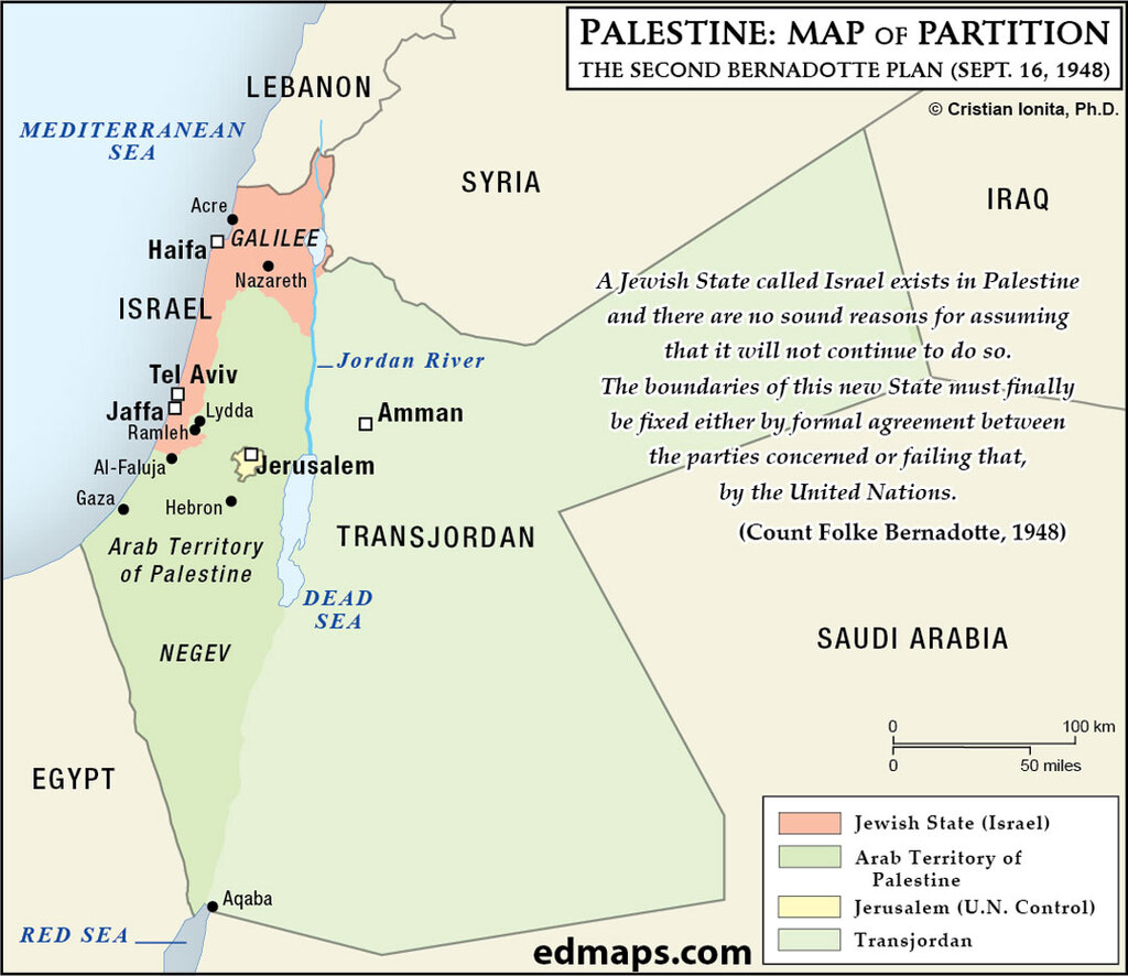
According to the new Count Bernadotte's September 1948 plan, Israel cedes Negev to Arabs and gains Galilee, with Jerusalem becoming an international city.
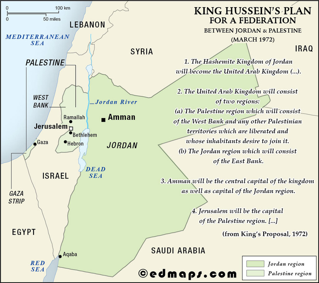
King Hussein's 1972 "United Arab Kingdom" plan merged West Bank (Arab Palestine) with Jordan within a Hashemite federation.
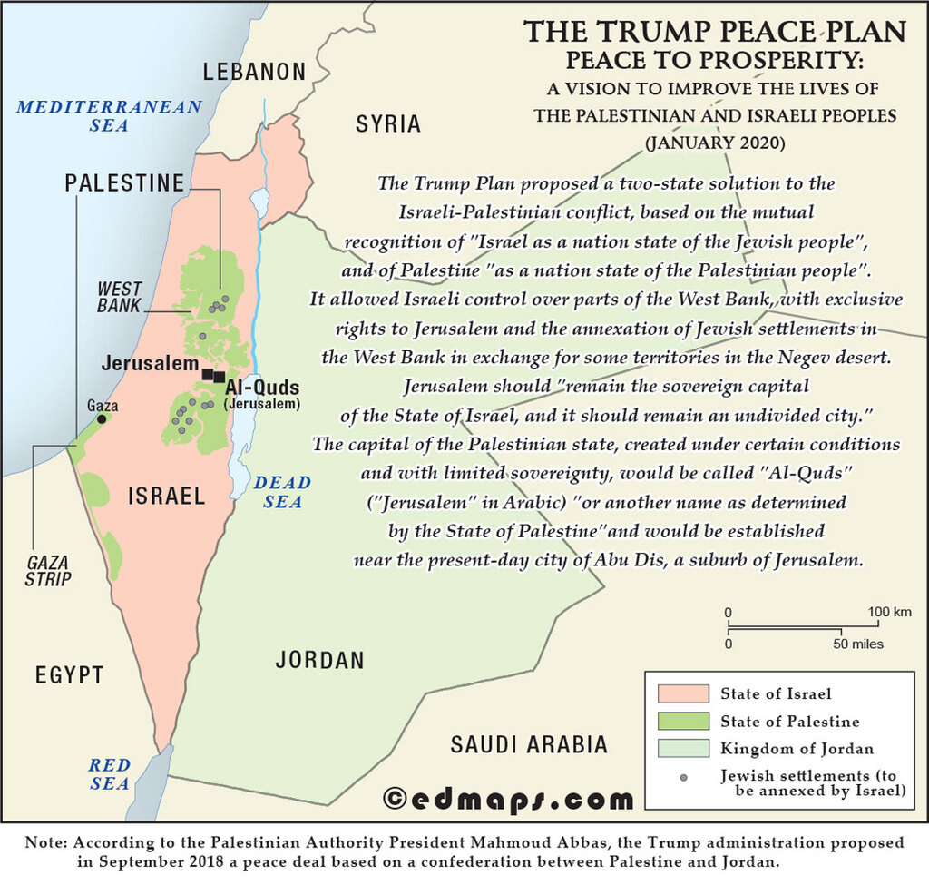
Trump’s 2020 plan proposed a Palestinian state with limited sovereignty, Israeli control over Jerusalem and the Jordan Valley, West Bank annexations, and no right of return for the Palestinian refugees.


Sources, Methodology & Educational Use: The maps presented on this page are original creations produced for edmaps.com by Dr. Cristian Ionita. Each map is based on verified historical data relating to the territorial evolution of the historical Palestine and the new political entities of Israel and Arab Palestine, including changes in borders, administrative structures, and regional historical developments. The maps are designed according to established practices in historical cartography, including source analysis, period contextualization, and visual clarity. The collection is curated to support teaching, learning, and public understanding of the region’s historical geography, and is intended for educational and non‑commercial use.
edmaps.com — Historical Cartography for Education
edmaps.com provides original maps and curated historical maps designed to support teaching, learning, and public understanding of history and historical geography. The original maps are created by Dr. Cristian Ionita, and all curated maps are selected from public archives, historical collections, and private holdings, and are presented for educational and non‑commercial use.
© Cristian Ionita. All rights reserved.
Website: https://edmaps.com — Contact: info@edmaps.com